⛰ Hike from the Inn valley up to the Bettelwurfhütte 📷🇦🇹 Wanderung vom Inntal hoch zur Bettelwurfhütte 🇩🇪
ENGLISH - GERMANY
Dear Steemians,
today I would like to introduce you to a hike in Tyrol, which I did this summer.
🇩🇪🇦🇹 Liebe Steemians, heute stelle ich Euch eine Wanderung in Tirol vor, welche ich dieses Jahr im Sommer gemacht habe.
The Bettelwurfhütte is located in the Karwendelgebirge, a few kilometres northeast of Innsbruck. The tour starts in the village of Absam in the Inn valley. The first part of the hike leads steeply up a road parallel to a stream. Enjoyable tourists and lazy hikers still drive up here to use one of the parking spaces further up Those who have managed the steep climb can take a break in the alpine guesthouse "St. Magdalena" and have a rest..
🇩🇪🇦🇹 Die Bettelwurfhütte befindet sich im Karwendelgebirge ein paar Kilometer nordöstlich von Innsbruck. Die Tour startet in der Ortschaft Absam im Inntal. Die ersten Teil der Wanderung geht es steil parallel zu einem Bach eine Fahrstraße hinauf. Genußtouristen und faule Wanderer fahren hier noch hoch, um einen der Parkplätze weiter oben zu nutzen. Wer den steilen Anstieg geschafft hat, kann im Alpengasthof "St. Magdalena" erstmal eine Rast einlegen und sich stärken.
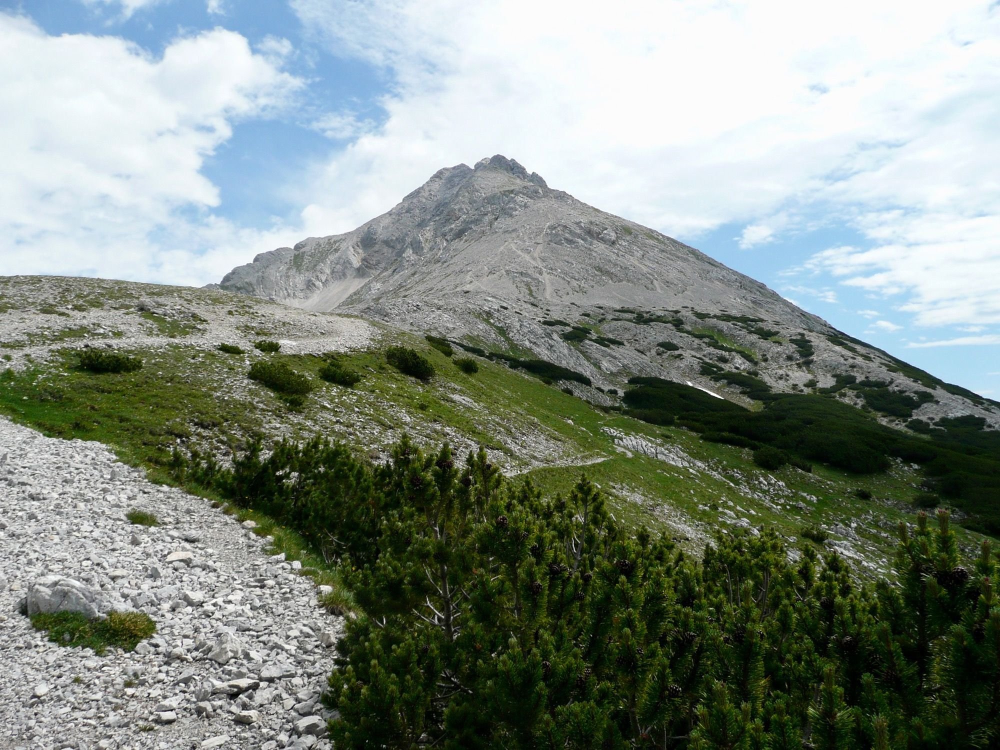
From the guesthouse you can enjoy a wonderful panoramic view of the Bettelwurf massif. With good eyes you can already recognize the destination of our hike, the Bettelwurfhütte.
🇩🇪🇦🇹 Vom Gasthof aus kann man einen wunderschönen Panoramablick auf das Bettelwurf-Massiv genießen. Mit guten Augen erkennt man auch bereits das Ziel unserer Wanderung, die Bettelwurfhütte.
There are several ways to reach the mountain hut. There are two steep climbs, one of which is a via ferrata (Absamer Klettersteig, http://www.bettelwurfhuette.at/klettersteig.html), and a comfortable and relatively safe but very long way through the Hall valley. I didn't take a picture of the cabin myself, here's one from Pixabay.
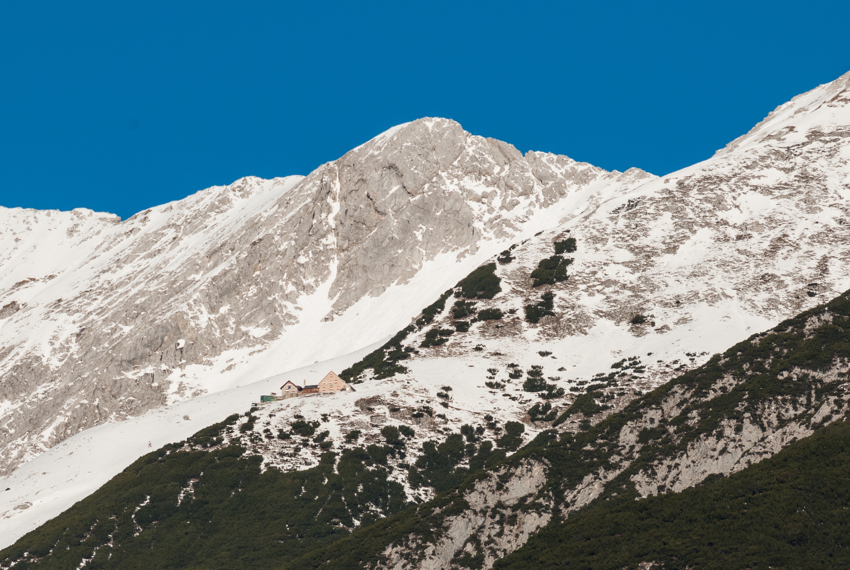
🇩🇪🇦🇹 Man kann über mehrere Wege zur Berghütte gehen. Es gibt zwei steile Anstiege, einer davon ist der Absamer Klettersteig (http://www.bettelwurfhuette.at/klettersteig.html), und ein gemütlicher und relativ ungefährlicher, dafür aber sehr langer Weg durch das Halltal. Ich habe selber kein Bild von der Hütte gemacht, hier eins von Pixabay.
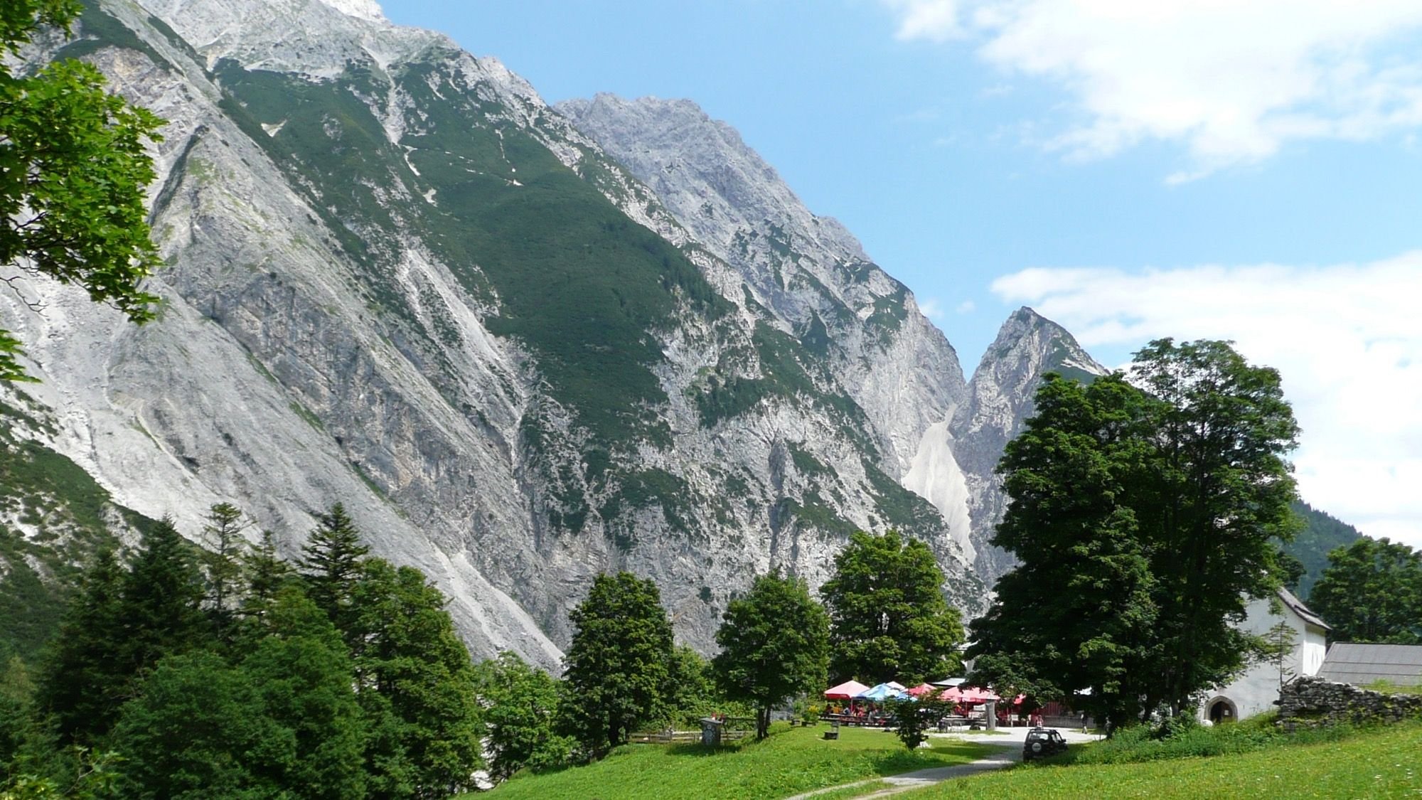
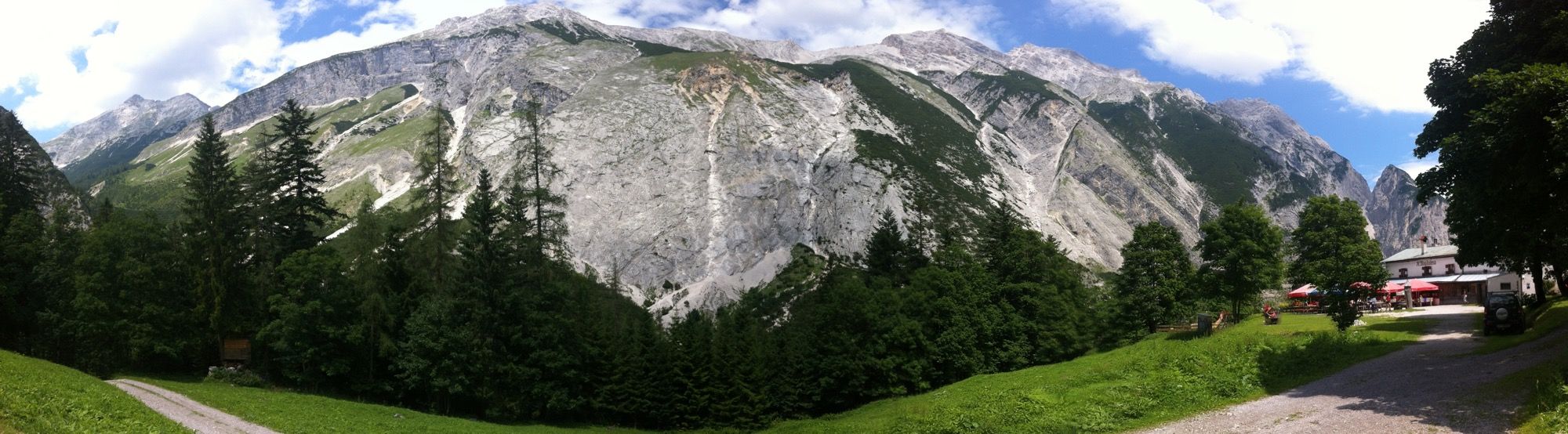
After a rest in the mountain inn "St. Magdelena" you walk a few kilometres westwards in the forest through the impressive Halltal. Even though there are still many trees standing here, you can always stop to relax and enjoy the beautiful view of the mountains.
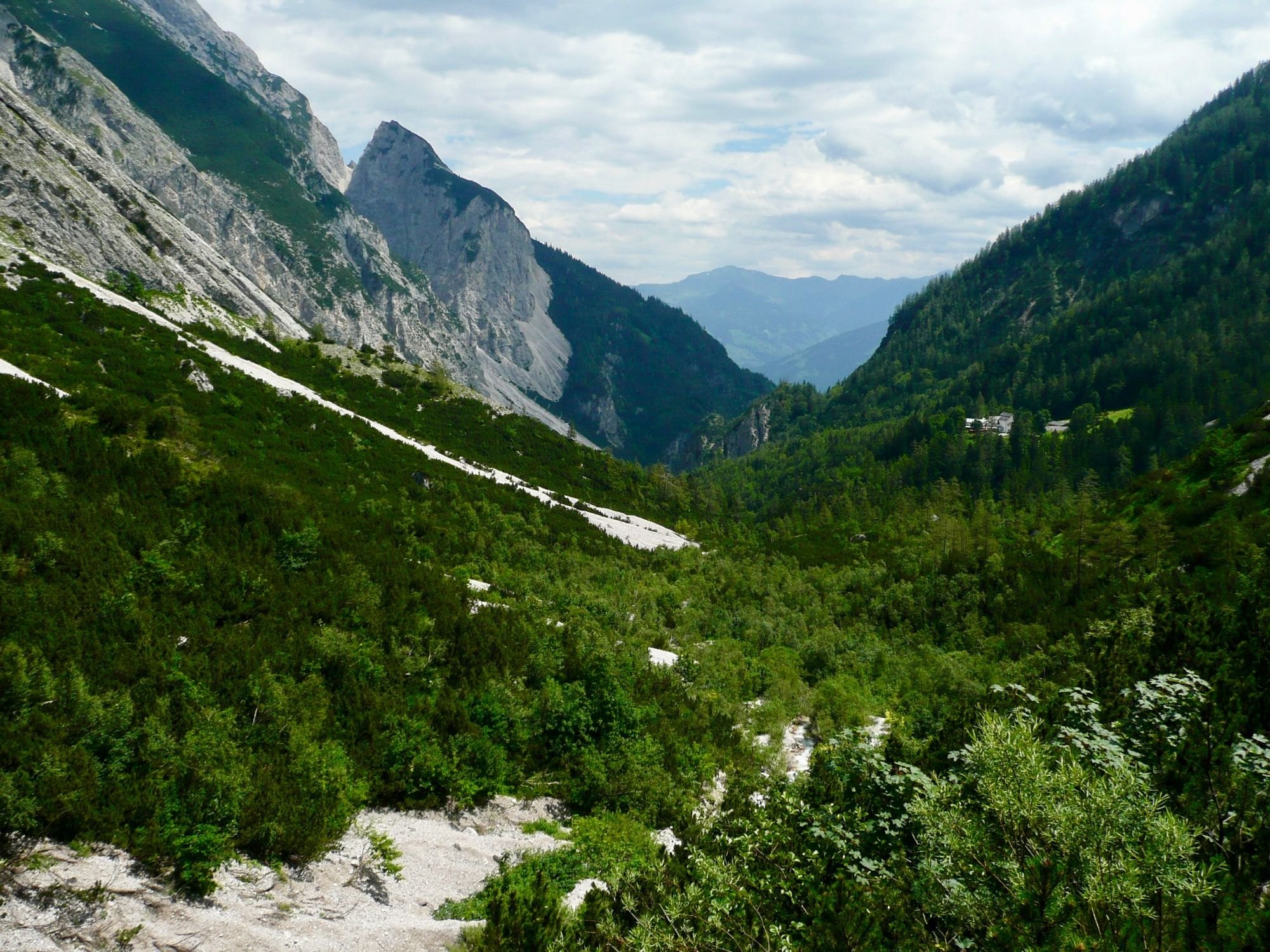
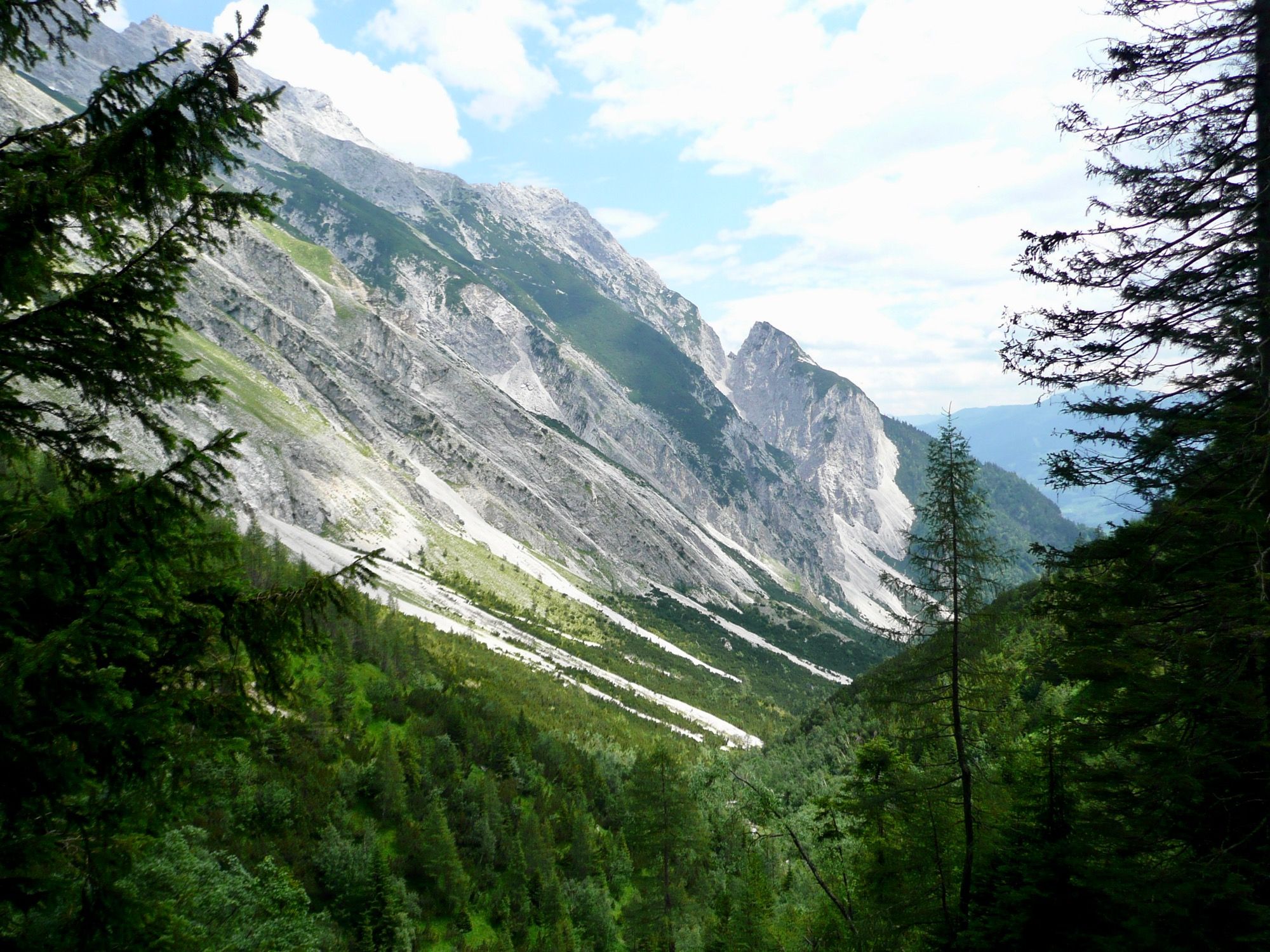
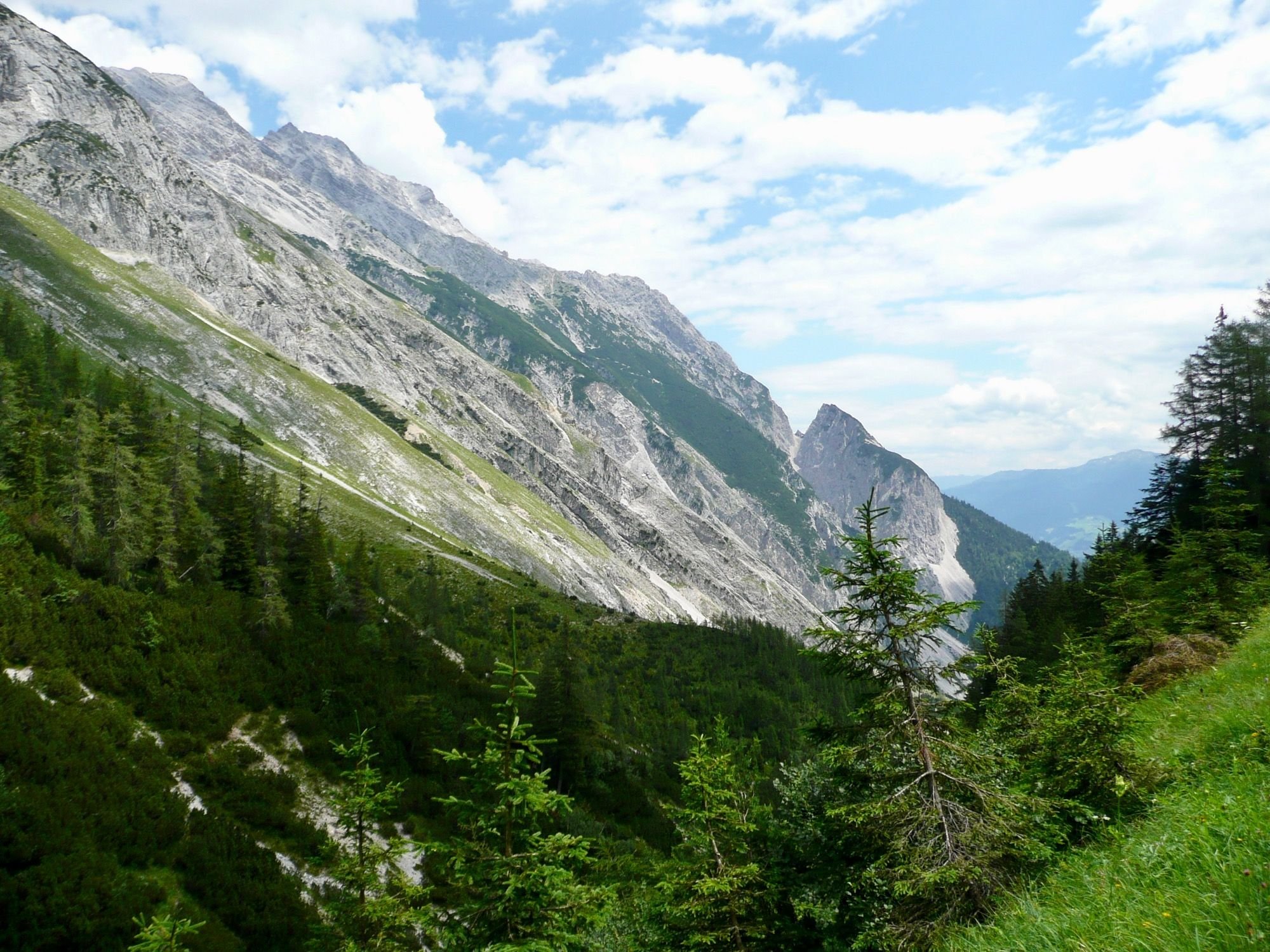
🇩🇪🇦🇹 Nach der Rast im Berggasthof "St. Magdelena" geht man ein paar Kilometer westwärts im Wald durch das beeindruckende Halltal. Auch wenn hier noch viele Bäume stehen, kann man immer wieder mal anhalten um sich zu erholen und um die schöne Aussicht auf die Berge zu genießen.
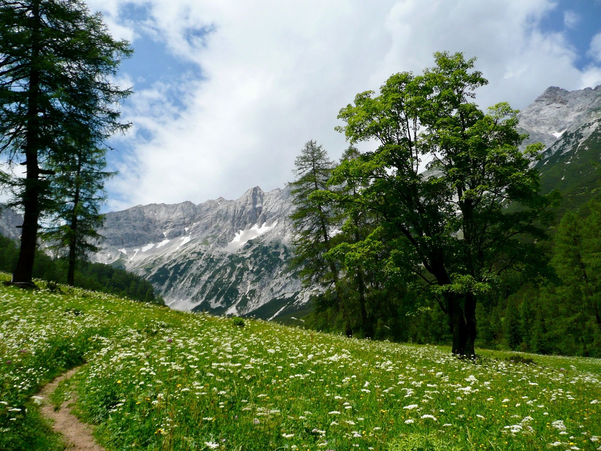
At the end of the Halltal valley you go over lush green meadows. This part of the valley is called "Issanger".
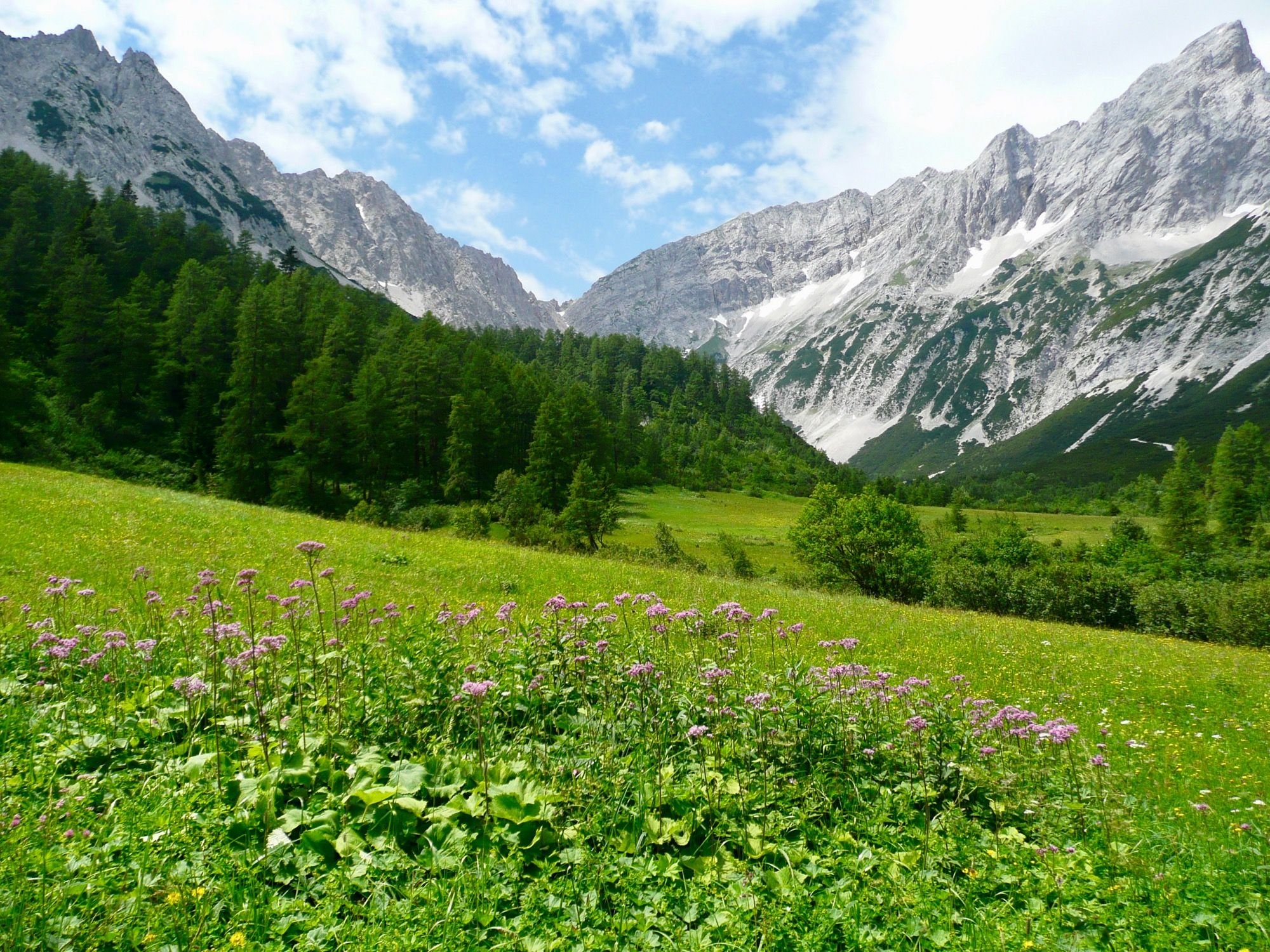
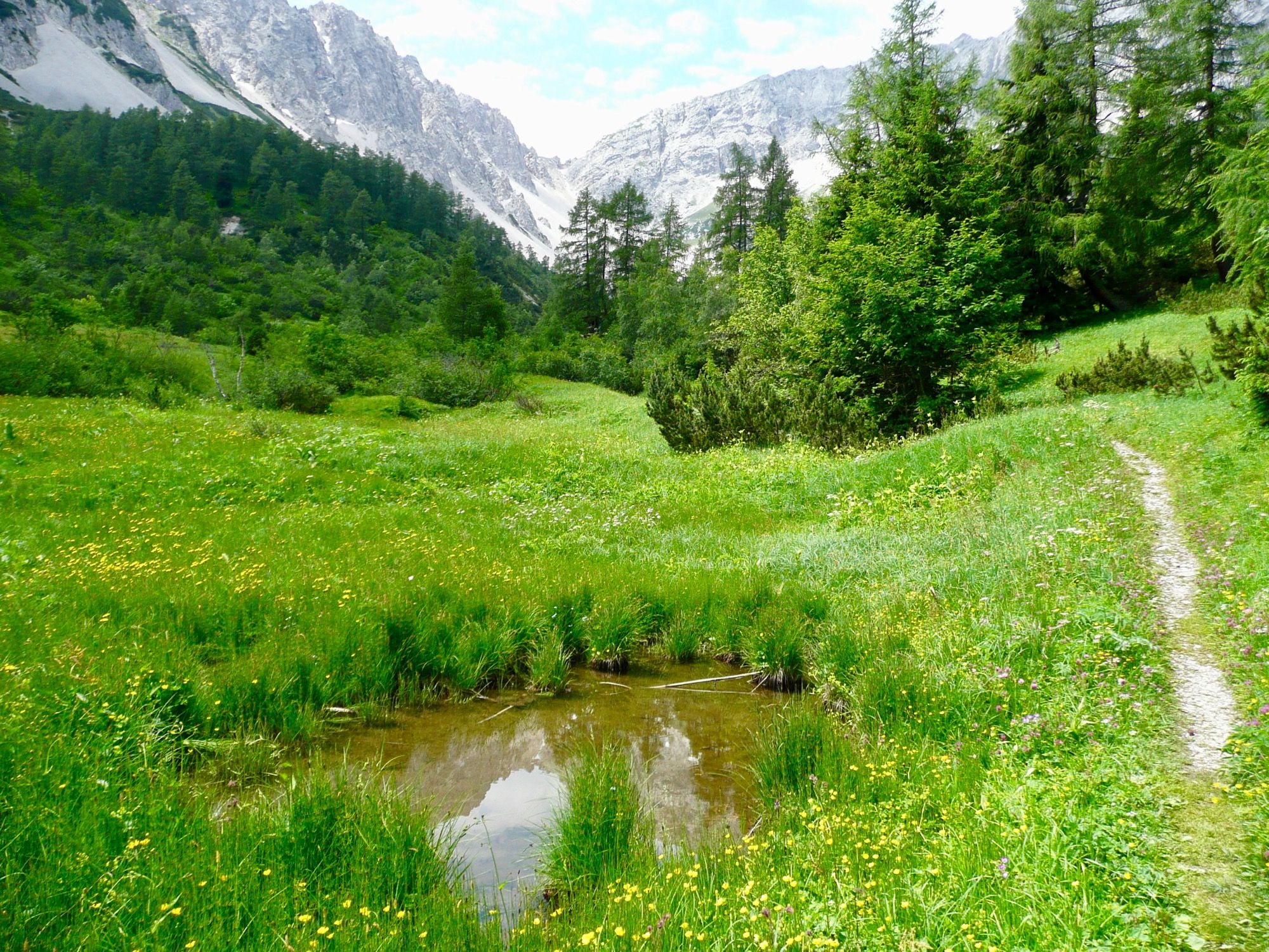
🇩🇪🇦🇹 Am Ende des Halltals geht man dann über saftig-grüne Wiesen. Dieser Abschnitt des Tales wird "Issanger" genannt.
We leave the meadows and continue on a gravel path. At the end of the valley our path turns northwards and we quickly gain altitude. The trees are getting smaller here, to the left and right of us only cripple pine trees can be seen.
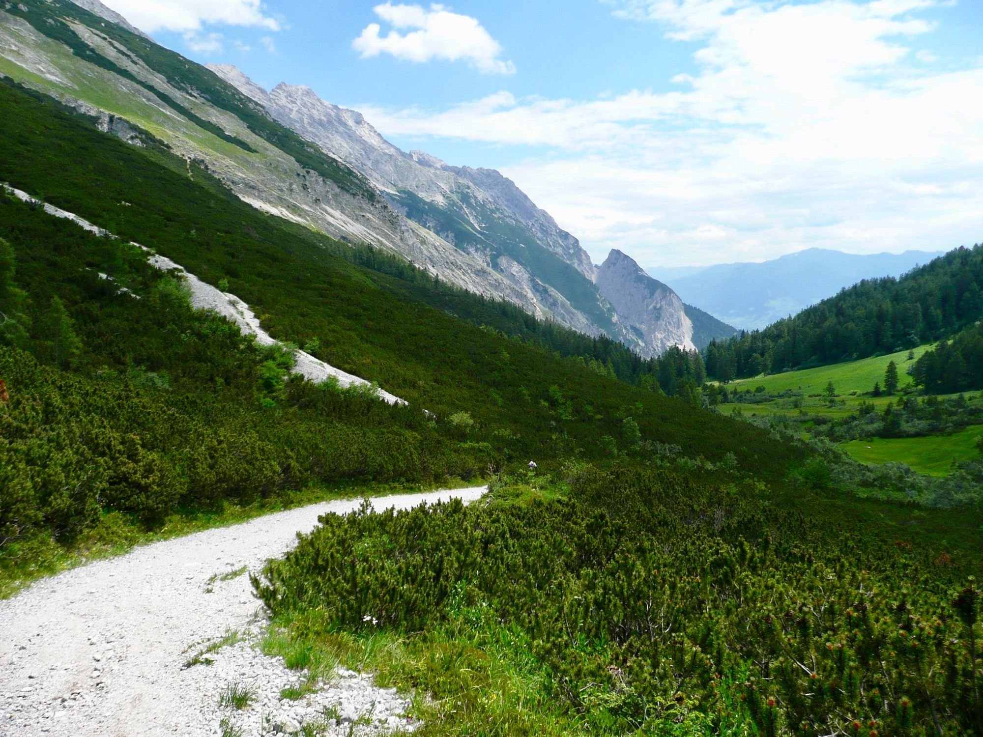
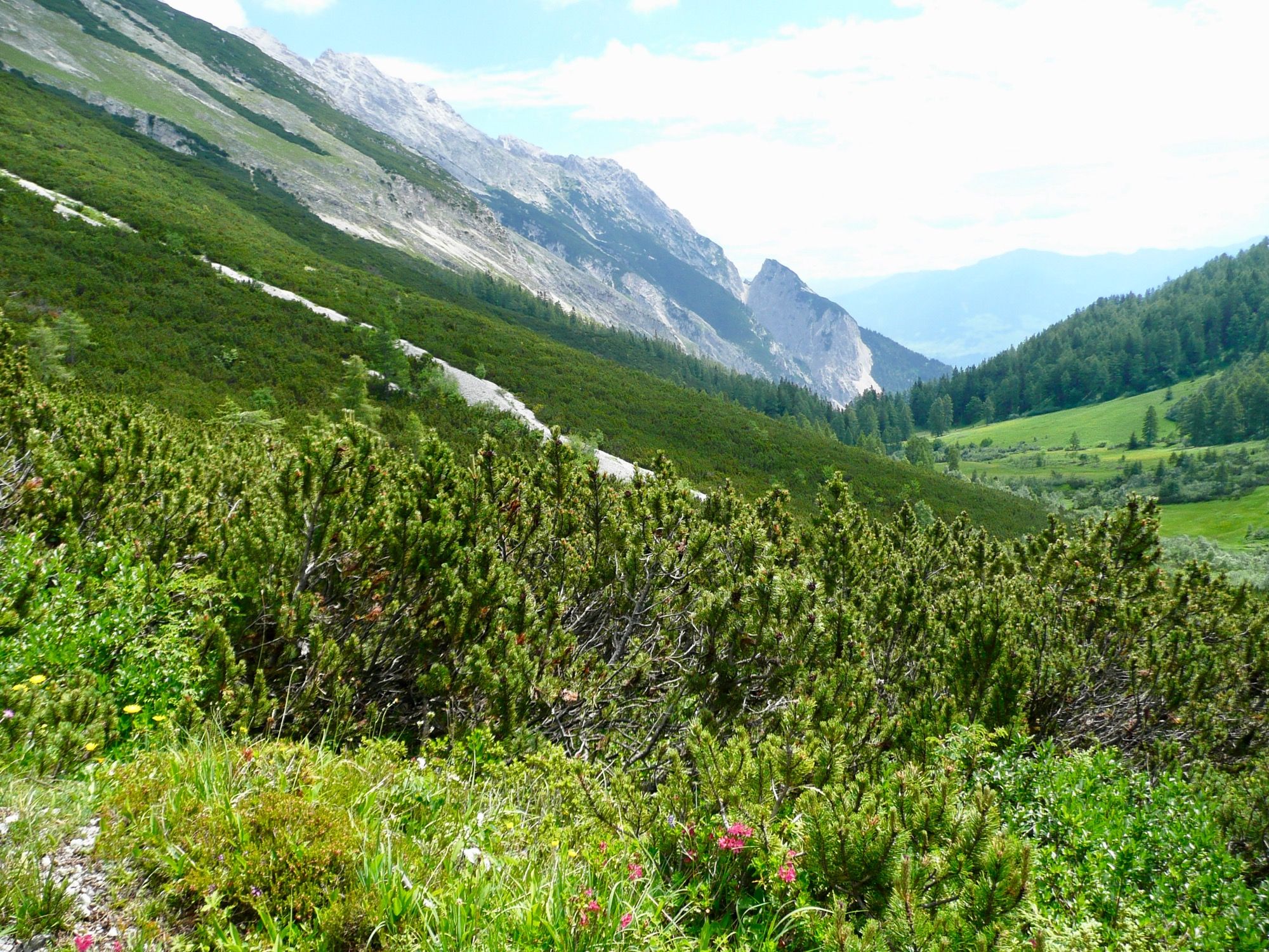
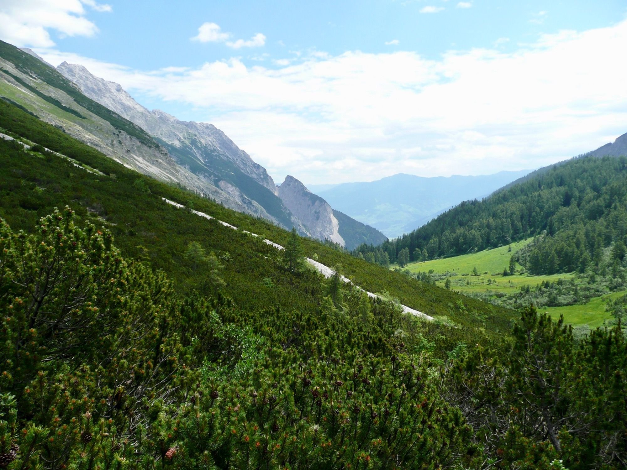
🇩🇪🇦🇹 Wir verlassen die Wiesen und gehen weiter auf einem schottrigen Wanderweg. Am Ende des Tals biegt unser Weg nach Norden ab und wir gewinnen schnell an Höhenmetern. Die Bäume werden hier kleiner, links und rechts von uns sind nur noch Krüppelkiefern zu sehen.
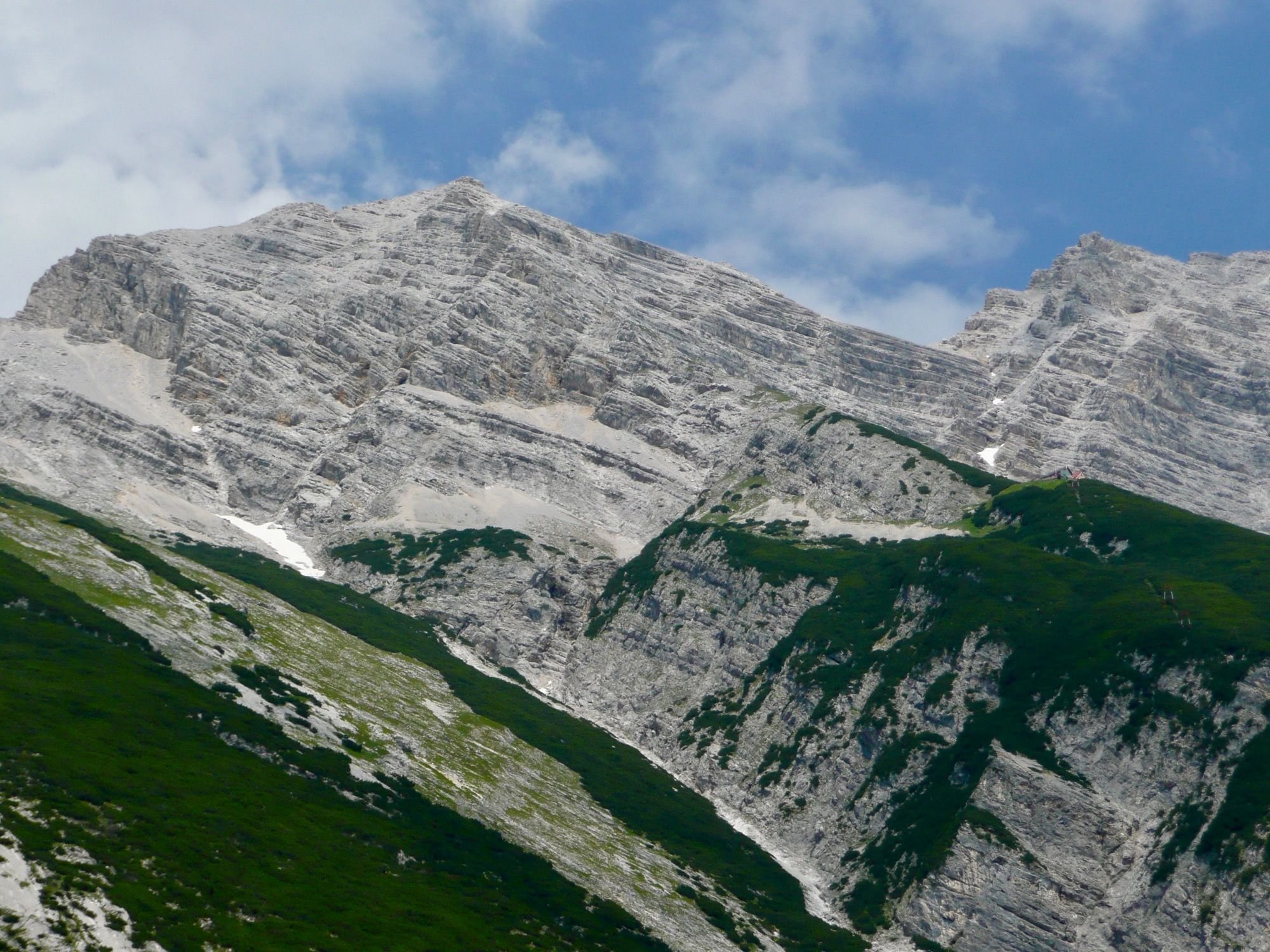
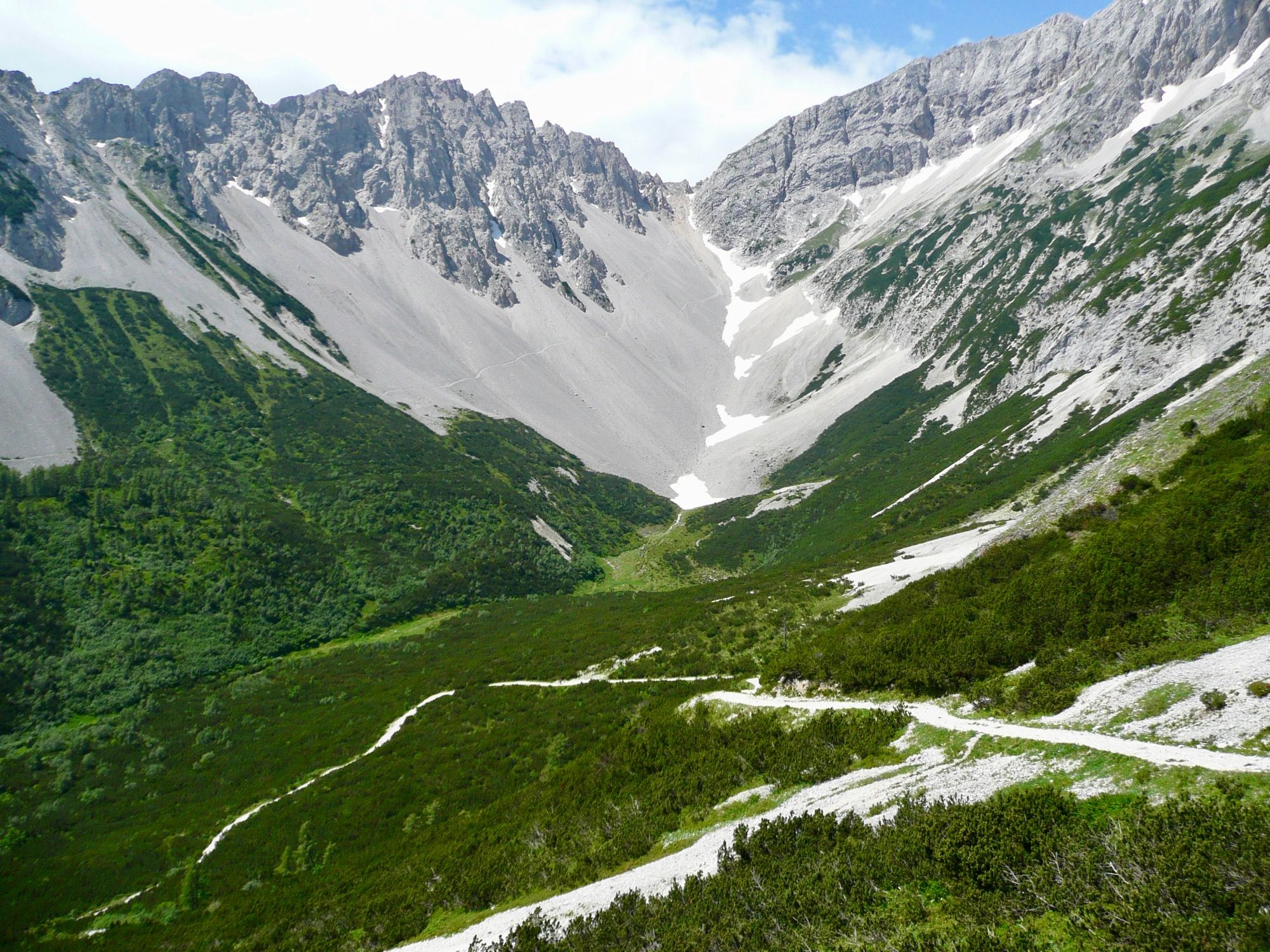
After the effort we reach the Lafatscherjoch. From here you can descend in the direction of Hallangeralm. But we go eastwards, always along the slope, a few hundred meters below the peaks. The path is relatively easy here, but sometimes you have to be careful not to stumble. Those who have a lot of stamina can also climb the "Signalkopf" from the Lafatscherjoch.
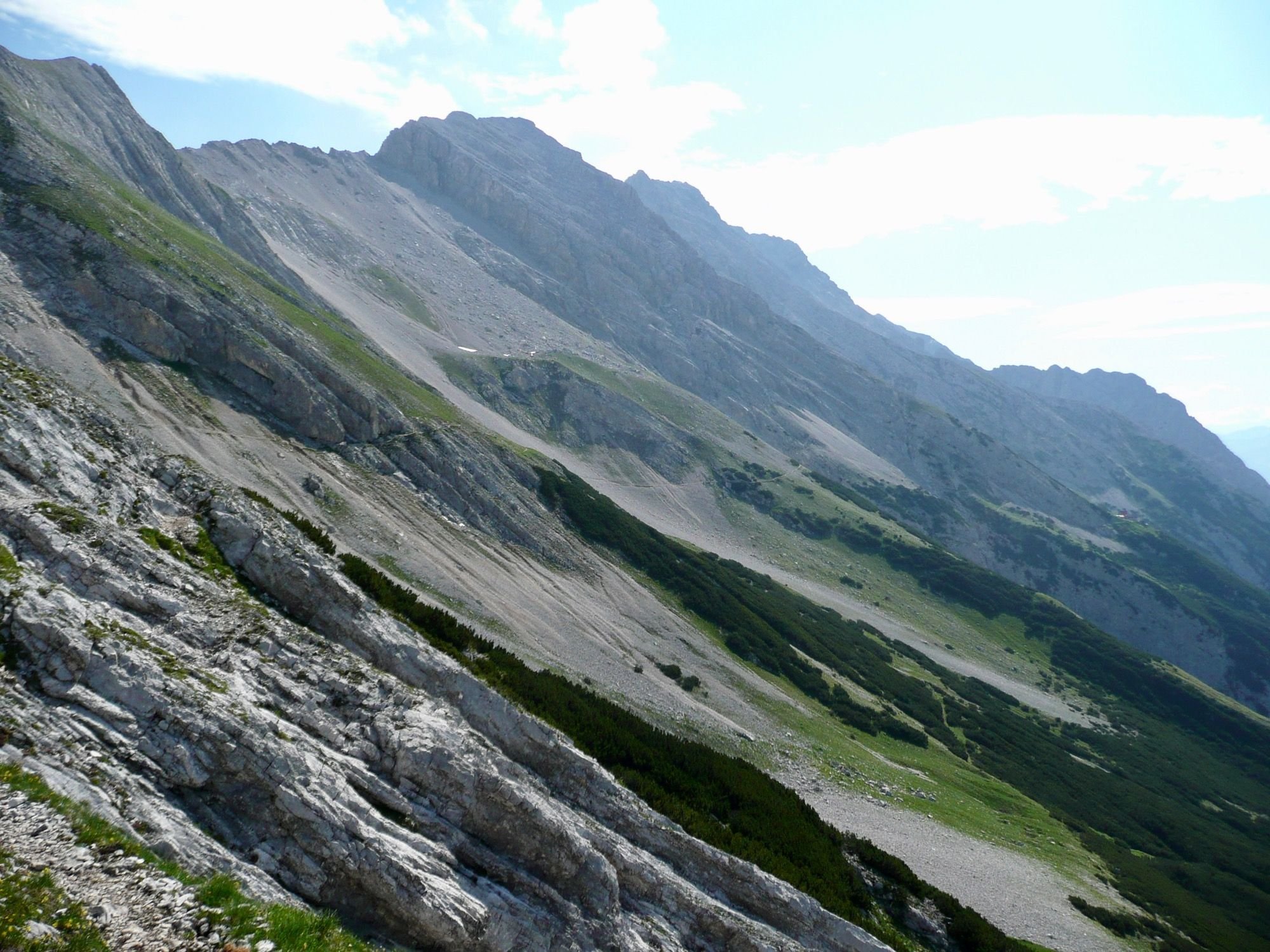
🇩🇪🇦🇹 Nach der Anstrengung erreichen wir das Lafatscherjoch. Von hier kann man Richtung Hallangeralm absteigen. Wir gehen aber Richtung Osten, immer am Hang entlang, ein paar hundert Meter unterhalb der Gipfel. Der Weg ist hier relativ einfach, manchmal muss man aber etwas aufpassen, dass man nicht stolpert. Wer über viel Kondition verfügt, kann vom Lafatscherjoch aus auch den "Signalkopf" besteigen.
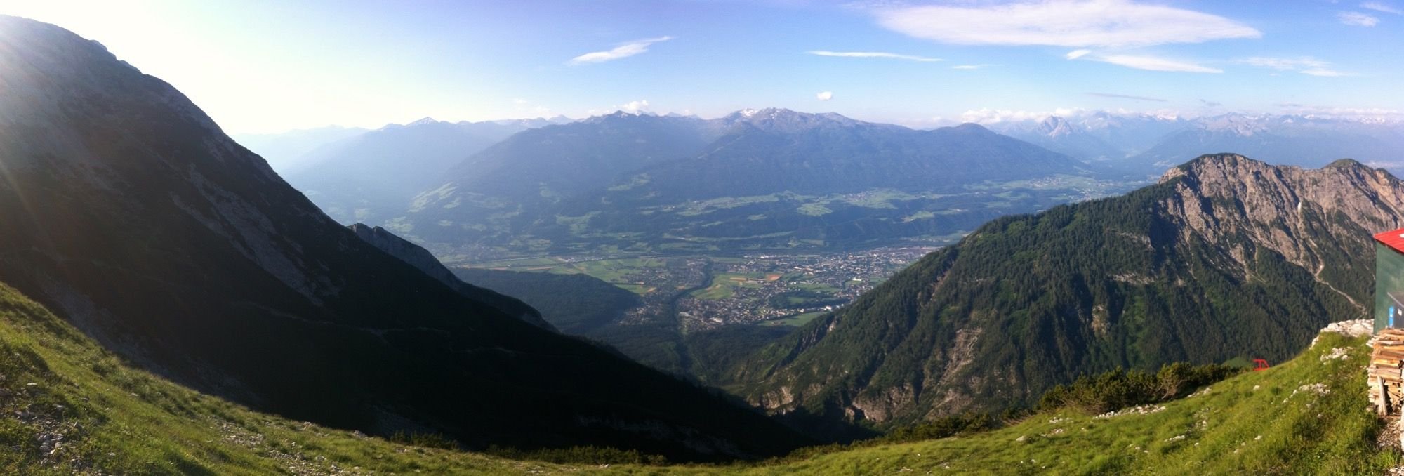
Shortly before the end of our hike we look back. Down in the valley you can see the mountain inn "St. Magdelena"and in the background the Inn valley. The city of Innsbruck hides behind the mountain.
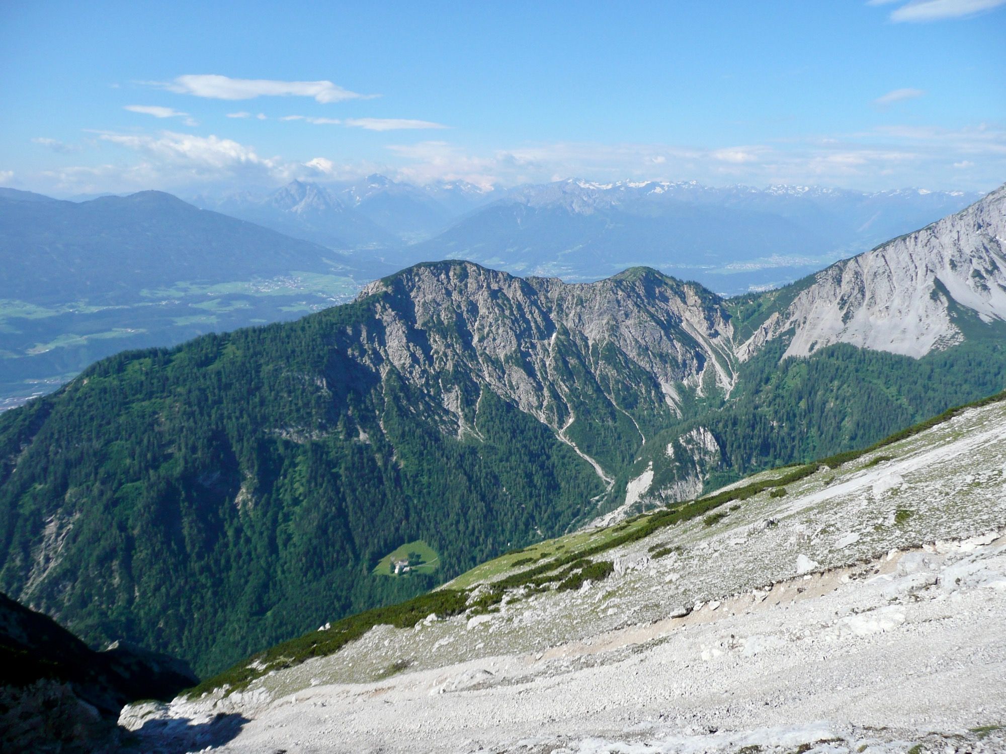
🇩🇪🇦🇹 Kurz vor dem Ziel unserer Wanderung blicken wir nochmal zurück. Unten im Tal erkennt man den Berggasthof "St. Magdelena", und im Hintergrund das Inntal. Die Stadt Innsbruck versteckt sich hinter dem Berg.
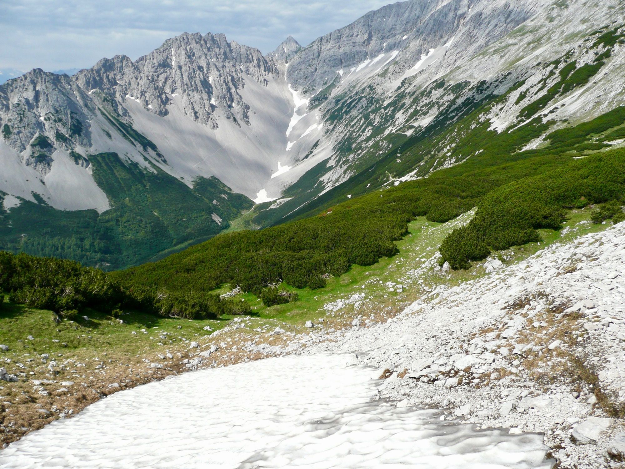
Shortly before reaching the finish, there was a great shock: a frozen snowfield, and that in mid-Summer (middle of July). Unprepared, i. e. without poles and crampons, we had left. Now we were 500 meters from our destination, and after 5 hours of hiking we didn't want to turn back and walk the whole way back, especially as we had booked an overnight stay in the mountain hut. After a half-hour break with a lot of discussions we ventured over the snowfield, fortunately without any losses in our hiking group.
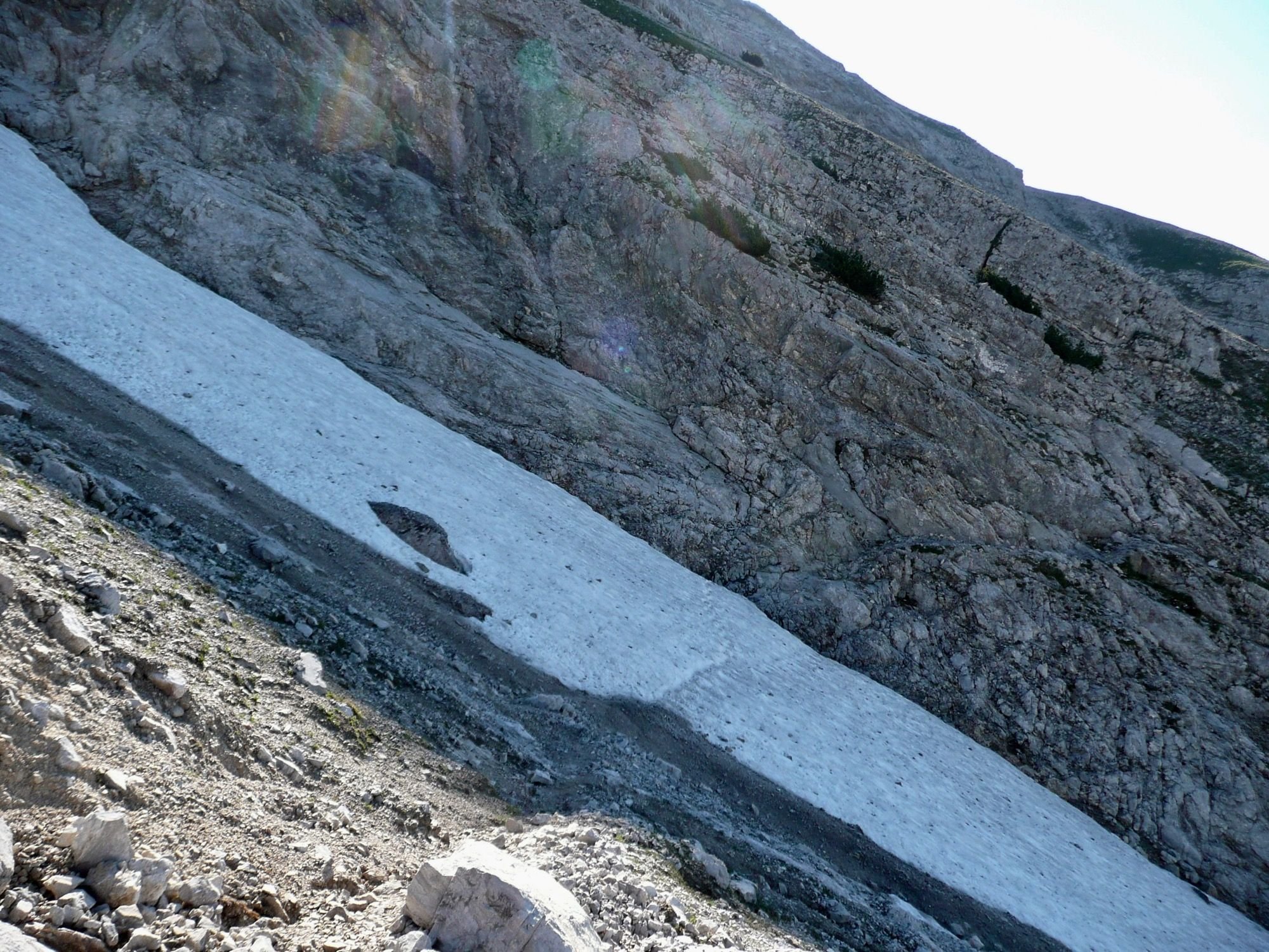
🇩🇪🇦🇹 Kurz vor dem Ziel dann der große Schock: ein verharschtes Schneefeld, und das im Hochsommer (Mitte Juli). Unvorbereitet, d.h. ohne Stöcke und Steigeisen, waren wir losgezogen. Nun waren wir 500 Meter vorm Ziel, und wollten nach 5 Stunden Wanderung aber nicht mehr umkehren und den ganzen Weg wieder zurücklaufen, zumal wir eine Übernachtung in der Berghütte gebucht hatten. Nach einer halben Stunde Pause mit viel Diskussionen wagten wir den Gang über das Schneefeld, zum Glück ohne Verluste in unserer Wandergruppe zu verzeichnen.
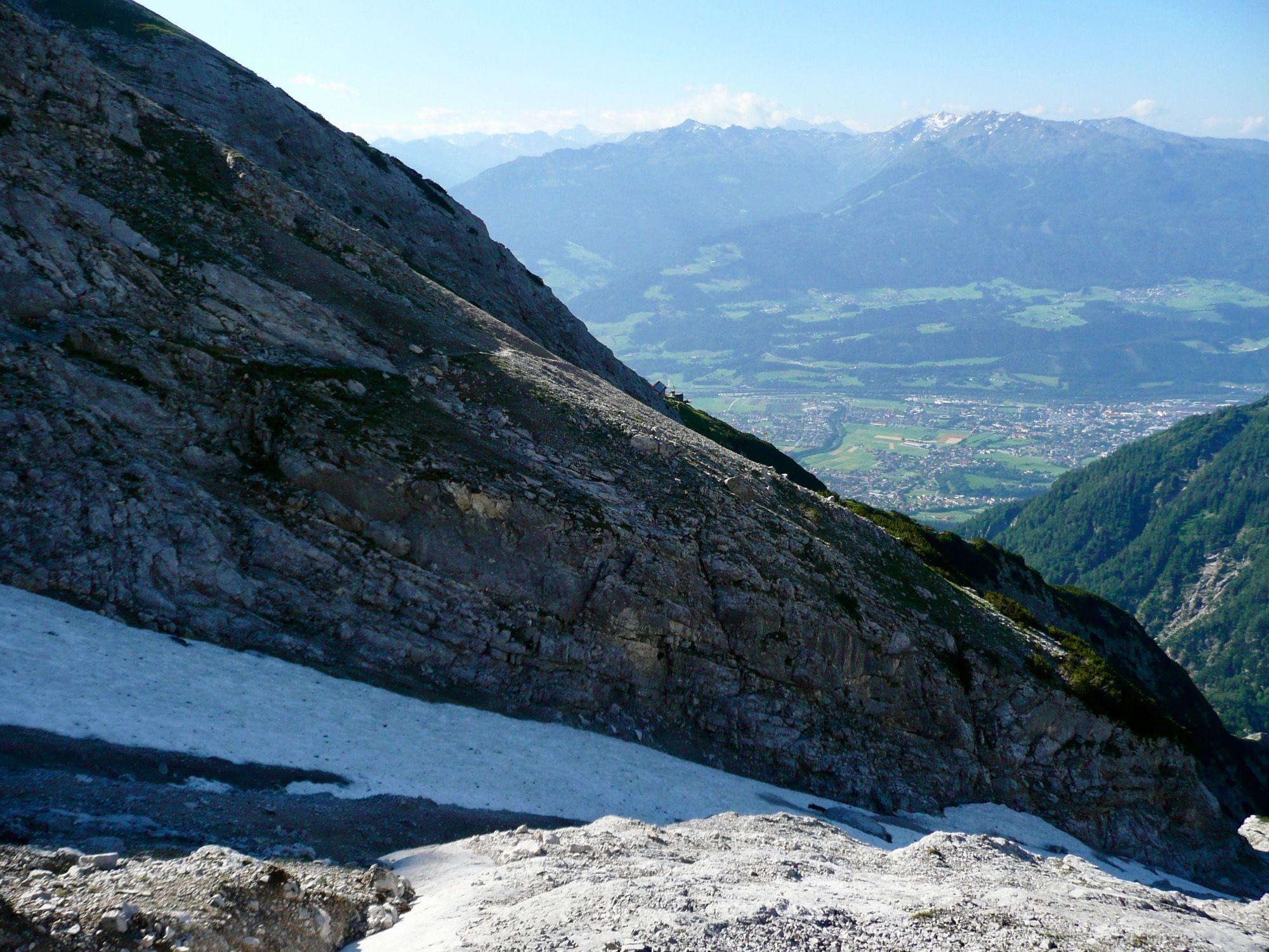
After the shock we couldn't really enjoy the view of the Inn valley at first, especially as the next day it went the same way back to the valley.
🇩🇪🇦🇹 Nach dem Schreck konnten wir zunächst die Aussicht auf das Inntal nicht so richtig genießen, zumal es am nächsten Tag den gleichen Weg wieder zurück ins Tal ging.
During the descent we went another way in the Halltal valley. Instead of crossing the meadows of the "Issanger", we walked along the driveway past the so-called "Herrenhäuser".
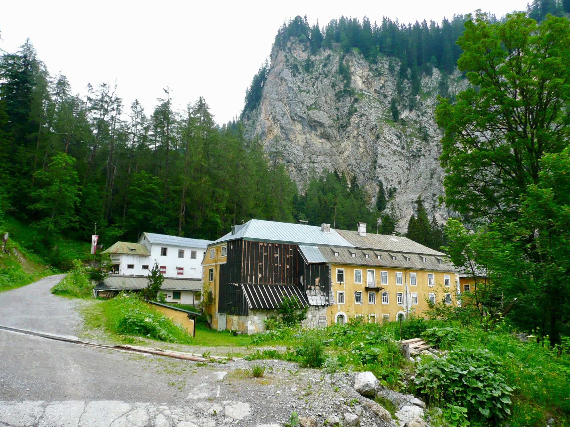
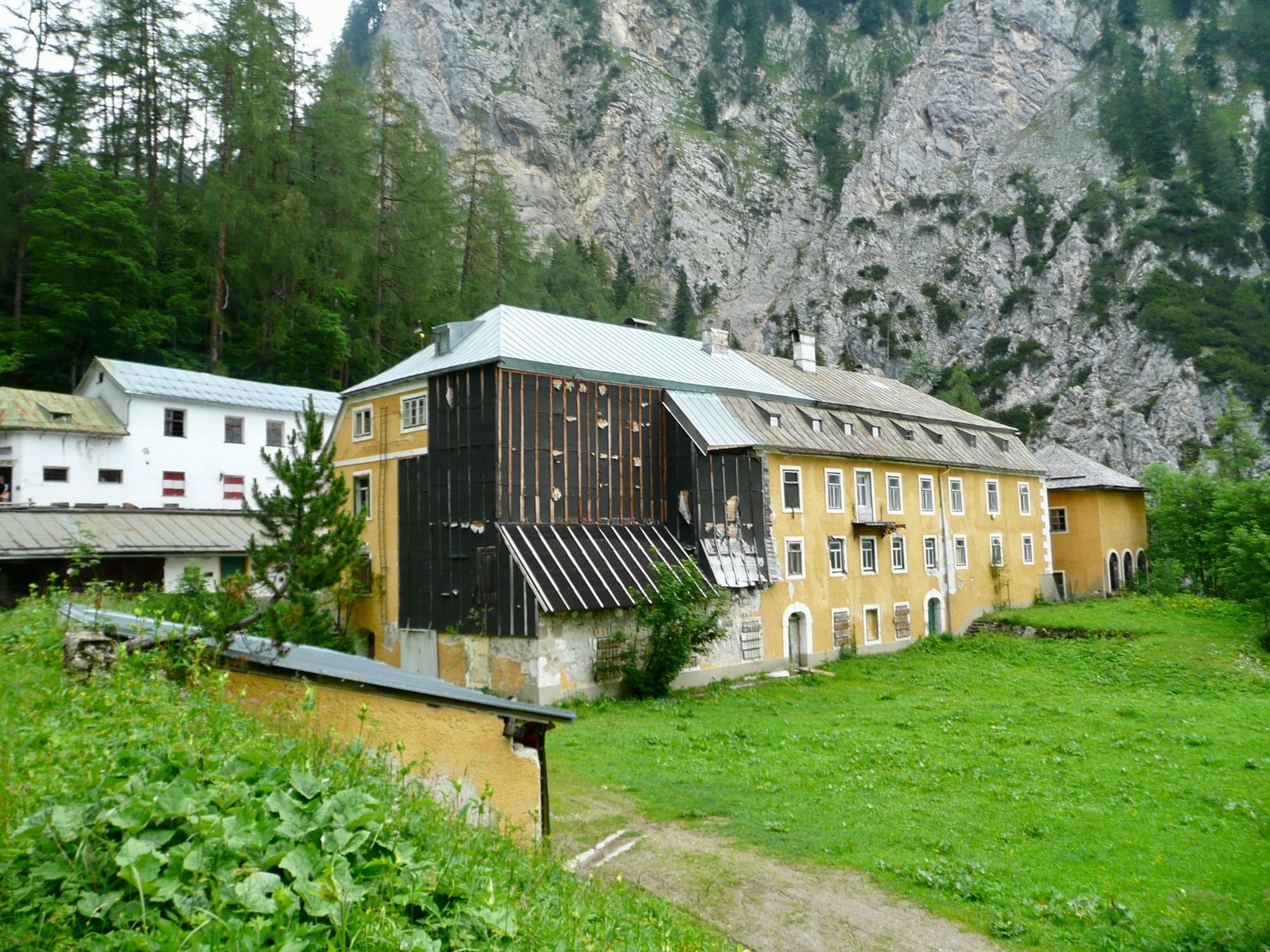
🇩🇪🇦🇹 Beim Abstieg gingen wir im Halltal einen anderen Weg. Statt über die Wiesen des "Issangers" liefen wir auf dem Fahrweg an den sogenannten "Herrenhäusern" vorbei.
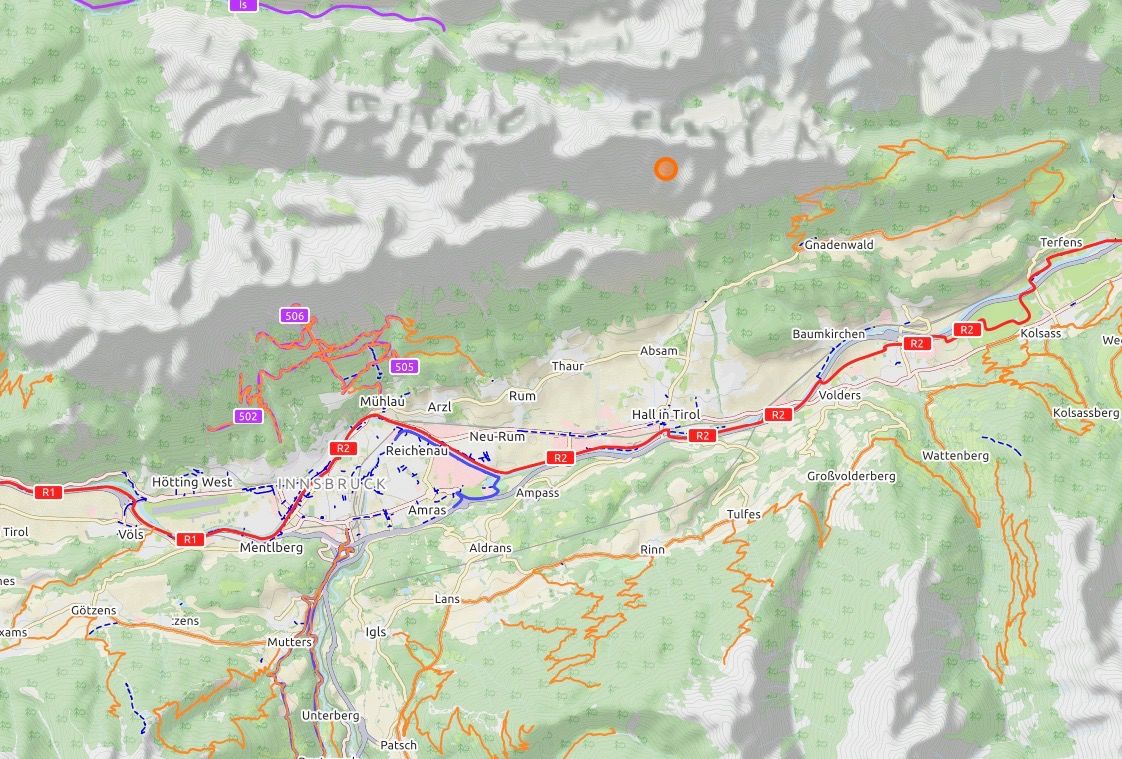
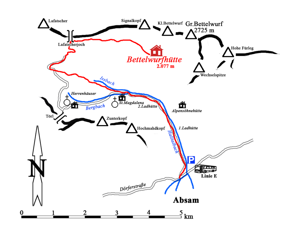
Finally, 2 maps of the hike presented here. The "Bettelwurfhütte" is the orange spot in the mountains northeast of Innsbruck. On the detailed map you can see the path presented here (the red line).
🇩🇪🇦🇹 Zum Schluß noch 2 Karten von der hier vorgestellten Wanderung. Die "Bettelwurfhütte" ist der orangene Punkt in den Bergen nordöstlich von Innsbruck. den Auf der Detailkarte sieht man den hier vorgestellten Wanderweg (die rote Linie).
No comments:
Post a Comment